Showing posts with label North South Track. Show all posts

Thursday, 26 April 2018

If Aus Mtn Running Champs Were One Week Later...


Fresh Autumn snow blanketed kunanyi / Mount Wellington a couple of Sunday's ago.  It was exactly a week after our mountain hosted the Australian Trail Running Championships.  What if the snow and the championships coincided?  


Panorama Track
Settled snow would have been encountered at the event's halfway mark on the steep Old Hobartians track.  Front runners would have encountered fresh powdery drifts approaching knee deep in the lee of bushes for the final stretch along the Zig Zag Track.  Winds approaching 100kph would have greeted runners at the finish with apparent temperatures below -20°C.

Loo with a View!
I'm sure was not the only one having those thoughts as I reveled in the conditions and enjoyed the irony of the timing.  I passed several other trail runners and hikers en route but, with the road closed and some good timing, I had the summit area to myself.

Leaving first prints in fresh powder - My Salomon SpeedCross 4s
A particularly nasty snow shower had greeted one of my trail running mates for his arrival at the summit a little earlier as I was battling my way up the road between The Chalet and Panorama Track in relative shelter.  Timing was on my side as blue sky and sunshine accompanied the icy winds for my brief summit visit.  Running down the road from the summit invoked a strange, euphoric feeling as the freezing conditions on my exposed skin contrasted dramatically with my core which still felt toasty from the uphill slog.


Summit selfie
The euphoria lasted for half the descent before sudden demotivation shocked me at the junction of Old Hobartians and the North-South Track.  My phone battery went flat - no Strava!!!


My Strava track with tell-tale straight line indicating battery failure half-way home.
The trudge over what Kylie and I call Priests Hill behind our house became unusually arduous.  The steep descent on the other side lifted my spirits briefly before hitting the more gradual drops on our backyard trails.  These became a snails-paced grind as I got annoyed at my Strava-induced withdrawal symptoms.


Actual stats were more like 21km in 3:23 for a respectable 9:40/km with 1300m ascent
My final kilometre struck a happier chord as I went low-tech, looked at my trusty Big W watch and started running some numbers through my head the old-fashioned way.  Despite feeling much of my descent was a drag, the overall average speed for my outing was a respectable 9:40/km - not terrible considering the  harsh conditions and overall ascent.  I arrived home a very happy trail runner!

Wednesday, 11 April 2018

2018 Australian Mountain Running Championships

Happy finishers
Fine and mild conditions (by Tassie standards) accompanied runners as they ascended through the stringy bark (E. obliqua) forests on kunanyi / Mount Wellington's lower slopes in the 2018 Australian Mountain Running Championships.  After leaving Talosa Park fire trails gave plenty of elbow room as social joggers like myself were soon separated from serious contenders on the steep sections before reaching the single MTB track at the head of Lenah (Kangaroo) Valley.

Aside from mingling at the start I had no chance of seeing the elite males.  However ladies started 5 minutes later so it was inspiring to see the first two elite ladies scoot past at the junction Merton/Kangaroo junction.  It's a real buzz to see the elite runners.  For me this feeling goes way back to 1985 when the first Burnie Ten gave me the opportunity to 'compete' in my home town against Steve Monaghetti in the first of his many road running successes.

Upon reaching the North-South MTB Track a delightfully level(ish) kilometre of berms and turns led into the mossy-floored, broad-leaf scrub beside the New Town Rivulet.  After crossing the clapper bridge a cheeky marshal advised, "Savour that fast bit.  You won't see any more downhill for a long time!"

Organ Pipes
As the steepness of Old Hobartians started to warm things up light rainfall set in - enough to cool things down but not enough to be miserable.  Sandstone overhangs, waterfalls and several switchbacks helped distract from the incessant climb.  A cheer squad at the Hunters Track junction clapped and enthusiastically voiced their encouragement giving an additional morale boost.

At the only road crossing on the course a quick refreshment at the Chalet heralded the longest flat section of the course.  Two kilometres of Organ Pipes Track kept runners around the 1000m level.  The first half gave opportunities to glimpse fluted dolerite columns peering through the mist above and fleeting views through the snow gums (E. coccifera) to the city below.  Recent track work on the second half produced a challenging quagmire which felt like running on glue and added to the entertainment value of the day.  I loved this section which felt like flying compared with the earlier uphill grind.  The bouldery sections were delightfully familiar and the slippery slop most entertaining.

Above the clouds on the way back down
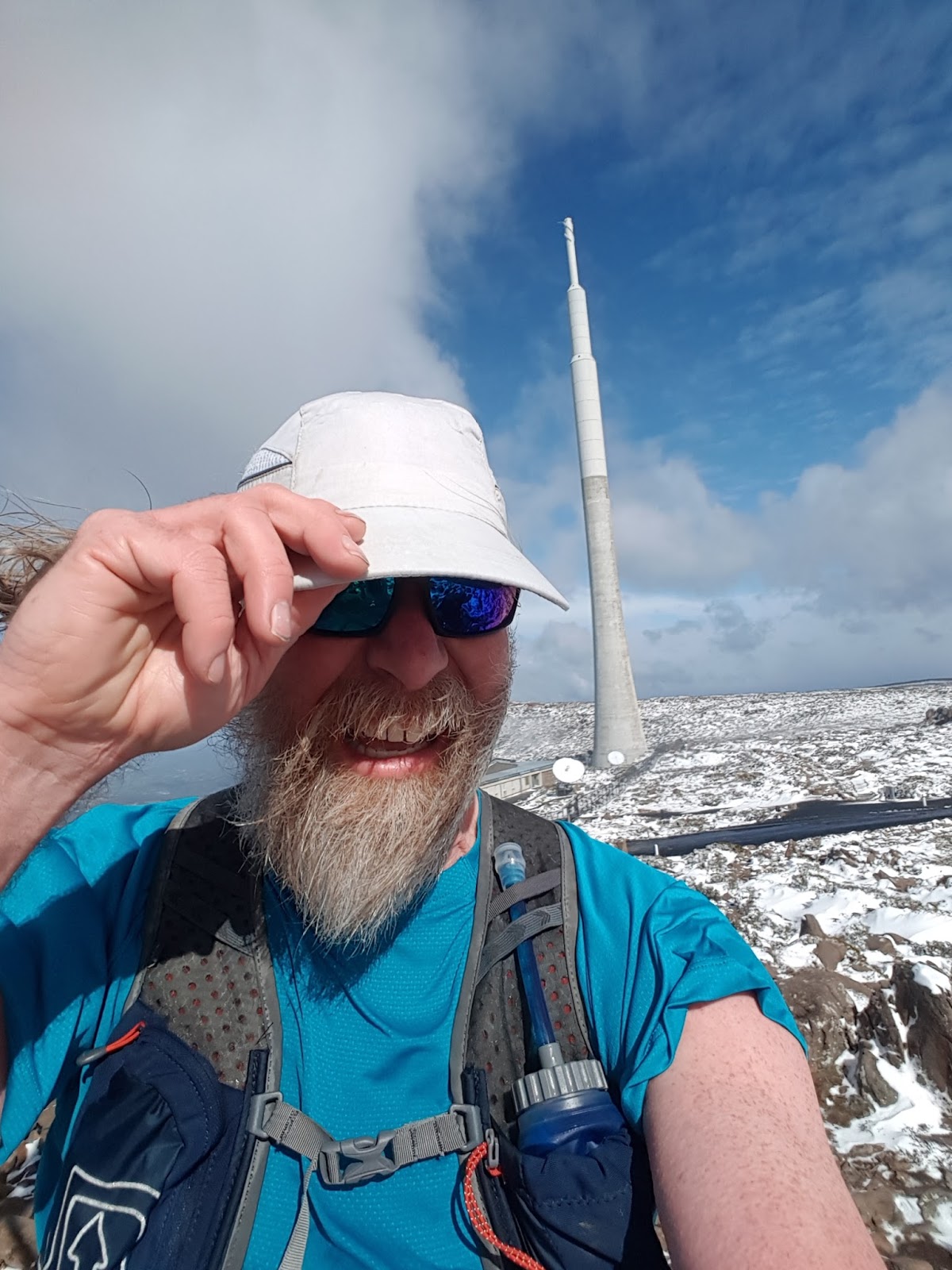
The Zig Zag Track should have presented the final hurdle - a 270m climb in little over a kilometre.  However, after completing that, the mountain had one more challenge in store.  Once the plateau was attained winds gusting around 65kph turned what should have been a fast, flat finish into a gruelling slog.  Those winds combined with a summit temperature of 8°C translating into an apparent temperature (wind chill) of -2°C making runners, both local and interstate, rush for their warm gear at the finish.

After a short break Kylie and I headed back down the mountain pleased that we had both beaten our PBs from the training runs of recent weeks.  Several runners had returned via the same route as the climb but we took the 1.5km shorter route down via the Panorama Track and arrived back at Glenorchy MTB Park with 30 minutes to spare before presentations.

Information about placegetters and complete results can be found on the Australian Mountain Running Association website.

Sunday, 25 March 2018

Australian Mountain Running Championships - 2018 Course Preview

Last month Kylie and I heard the Australian Mountain Running Championships will be held in our backyard on 8th April this year.  Further investigation revealed the course includes our favourite section of the Back Yard Loop.  As if to entice us even further they have a non-championship section, presumably for social runners like us, which has the added inducement of wine and chocolate as random prizes.  (There's no mention of wine and choc for the championship runners!)

So...  We're entered.


kunanyi / Mt Wellington (on the left) as viewed from the start line at Glenorchy MTB Park
Between us we've now done several practice runs.  The actual event will start at the Glenorchy MTB Park and end at the kunanyi / Mt Wellington pinnacle after which organisers will somehow magic us back to the start.  Here's a detailed description of the course.

SPOILER ALERT: If you want the course to be a surprise look away now!

North South Track
The first 400m up Tolosa Fire Trail gently gains 40m.  After swinging left onto the Merton Fire Trail the next 600m ups the ante with a further 100m gain.  A well earned reprieve at the 1km mark passes through the delightfully flat '5-ways' junction at the top of Glenorchy MTB Park before climbing incessantly on Priests Fire Trail.  To the left our National MTB Downhill track ducks, weaves and frequently plunges down seemingly impossible slopes - well beyond the capability of mere mortal MTBers like me!

Sandstone outcrops on Old Hobartians Track
A further 180m height gain is celebrated at the 2km mark where the route suddenly becomes only slightly undulating for the next 1.5km.  The short (350m) Kangaroo Fire Trail leads on to the North-South MTB Track and heralds the start of single-track which endures for the remainder of the course.  A delightful section of forest leads to a clapper bridge crossing of the New Town Rivulet.

The recently upgraded (and still sloshy in places) Organ Pipes Track
The next 3km adds 590m to the altimeter along the Old Hobartians and Hunters Tracks.  The climb initially follows the rivulet before swinging away on a series of switchbacks.  The first zig and zag feature impressive sandstone outcrops while further up a pair of waterfalls are crossed either side of the Lost World junction.  (Care must be taken not to go straight ahead onto the Lost World Track soon after the first waterfall!)  After joining the Hunters Track the route crosses Pinnacle Road at The Chalet where fresh mountain water is conveniently piped to a road-side tap.

The Organ Pipes
Behind The Chalet the Organ Pipes Track levels out for a fast, rocky and, at times, sloshy 2km traverse under the spectacular dolerite cliffs.  If the weather is fine there are likely to be climbers overhead taking advantage of the dozens of routes on the vertical columns which feature 120m of vertical drop.

Hobart from the Zig Zag Track
At roughly 8.5km from the start the Zig Zag Track poses the final challenging ascent with a further 220m of height to be gained.  By this stage running will be a tall order for all but the most elite runners with high steps adding insult to injury.  The final 500m only climbs 30m in height so any remaining energy can be spent on a spectacular sprint finish to impress the tourists who marvel at our madness.


Summit selfie - Wind speed was 130kph that morning!

Saturday, 29 July 2017

Back Yard Rain & Snow

Up and down tracks of my Pearl Izumis
(...and the 4WD tracks of a techo working on the TV towers)
A couple of runs to report in the past week.  Last Sunday some rain had switched on the New Town Rivulet at the Clapper Bridge.  This was a pleasant contrast from last week when we found the stream unseasonably dry. Puddles, light rainfall, wet forest smells and soft ground underfoot were all welcome on a lively loop.  Not our quickest time but not slowest either.


Clapper Bridge with water this week
On Wednesday fresh snow bedecked kunanyi / Mount Wellington making a spectacular sight from our back yard.  Late morning I headed out on the usual back yard loop.  After crossing the Clapper I turned right and headed uphill.  Light sleet greeted me just after the sandstone outcrops on Old Hobartians and a full-on snow flurry greeted me at The Chalet marking 1,000 metres above sea level.


Snow falling at the 1,000 metre level
From there on settled snow ensured I would have the road legs either side of the Panorama Track to myself.  A couple of winters ago a huge dump of snow famously hit Hobart.  On that occasion snow drifts were over 3 metres deep when Kylie and I followed the deep swathe freshly cut by the snow plough.  Back then there was no way Panorama could be an option.  In contrast this week's run was barely ankle deep at the most and Panorama was eminently 'followable.'


Panorama Track
At the summit I paid the obligatory visit to the trig point and, in the complete absence of other people, I also jogged out to each of the lookout points.  With a keen breeze blowing over the top and the mercury hovering around -2°C it was not time to linger so I scooted back down and completed the remainder of the back yard loop followed with the usual warm-down stroll up the hill to home.


Summit view to the north-east
Summit view to the south-east

Some vital statistics for the backyard loop with summit side trip:
Duration 3:24:38
Distance 22.4km
Avg pace 9:09 min/km
Ascent 1,096m
Descent 1,122m


Summit selfie

Tuesday, 18 July 2017

Back Yard Loop - Bridges

Yesterday was a relaxing home day - perfect for getting back into running with a gentle back yard loop.


Mini troll's bridge
I mentioned the loop in my first bog post (Inspiration).  There are many facets to our loop which I could describe in more detail.  No prize for guessing what trail features caught my attention on this particular run.


Clapper bridge
As I took the photos I had to remind myself what season it is.  In summer, sections of the rivulet (pictured above) flow below ground... and July it would seem.  Many places in Eastern Tasmania have just had their record lowest June rainfall.  Sure, it's been cold and there have been days with snow on the mountains but there's plenty of talk about the dry.  Farmers are worried the ground will be too dry to sow their crops.  The Hydro are watching their dam levels* with fresh memories of our power connection to Victoria breaking during a record dry spell in 2015.


Ford
So, local trail runners, can you recognise any of these locations?  Apart from the first photo, all the other river crossings pictured are on the same watercourse.


Wooden bridge
From an engineering perspective the most interesting crossing would be the clapper bridge where a large slab of rock has been carefully perched.  For trail runners, the ford and stepping stones are a lively aspect of the run when (normal) winter snowfall and rain swell the rivulet to overflow these features.


Stepping stones
* Earlier this month I saw a Mercury headline claiming Hydro were worried about storages.  I tried to link the article but decided against it due to the pay wall.  When I looked for another news outlet reporting the story I found this correction from the Hydro (also linked above).  While the Hydro may not be 'nervously' watching storage levels, I stand by my statement that the Basslink failure would still be fresh in many people's minds.